


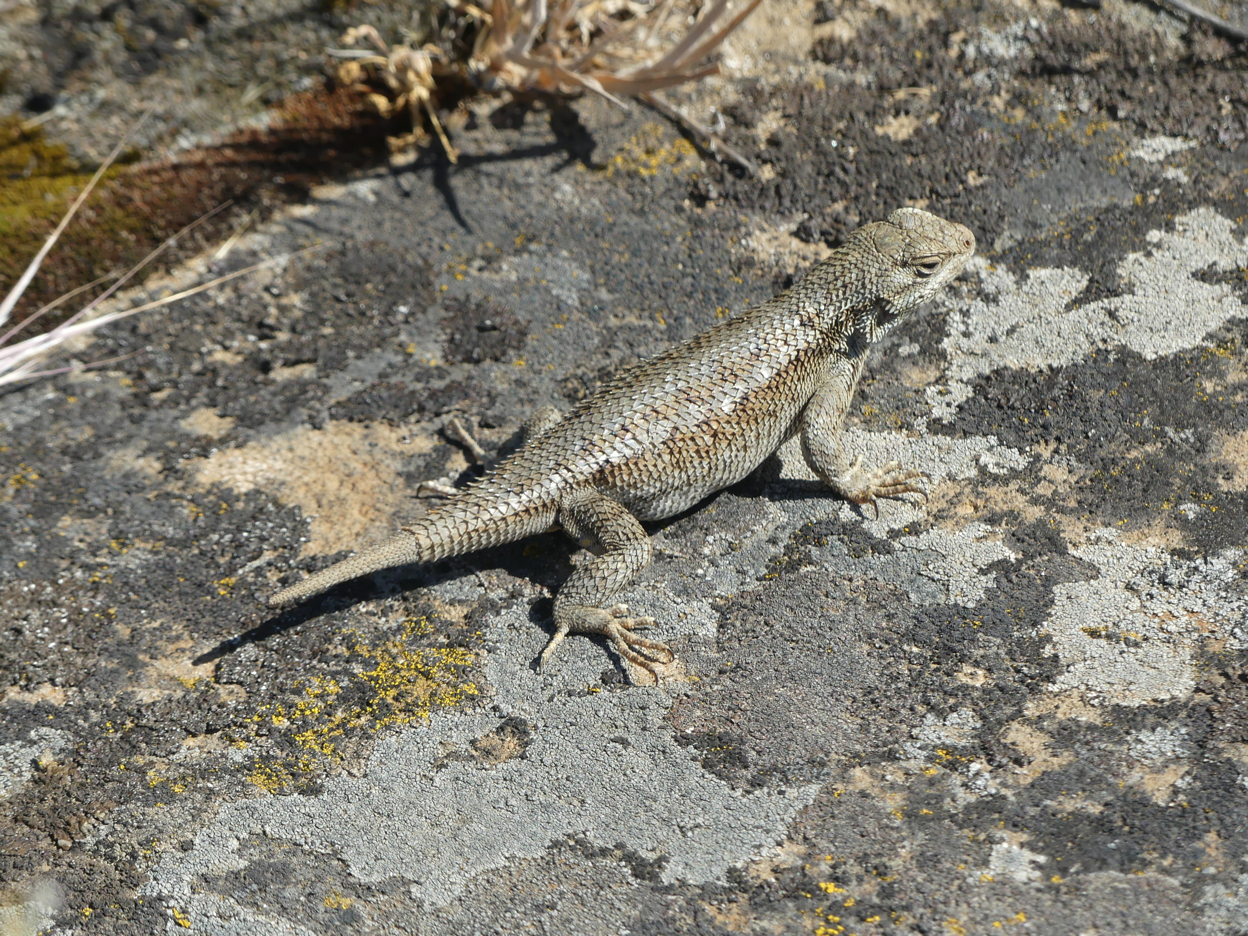
In my last post https://okanaganokanogan.com/2022/11/22/39-you-say-skaha-i-say-sqexeʔ/, number 33 in this series, I pointe out that even the simple concepts that determine human relationships to land today, things universally dispersed or at least fought over in Cascadia, things like resources, land, water, travel and property, are forms of colonialism over things like this:

The Lower Similkameen, Near Shanker’s Bend
Here, the living environment of the river has been divided between two countries. The image shows part of story held by the US land claim. Canada’s similar claim is to the right (north). The people who became a people at the same time the land became a land, and whose cultural practices contributed to the evolution and adaptation of the landscape here, as it did to them, had their main settlement a few miles downriver, near the gold rush town of Oroville, in the American Camp.
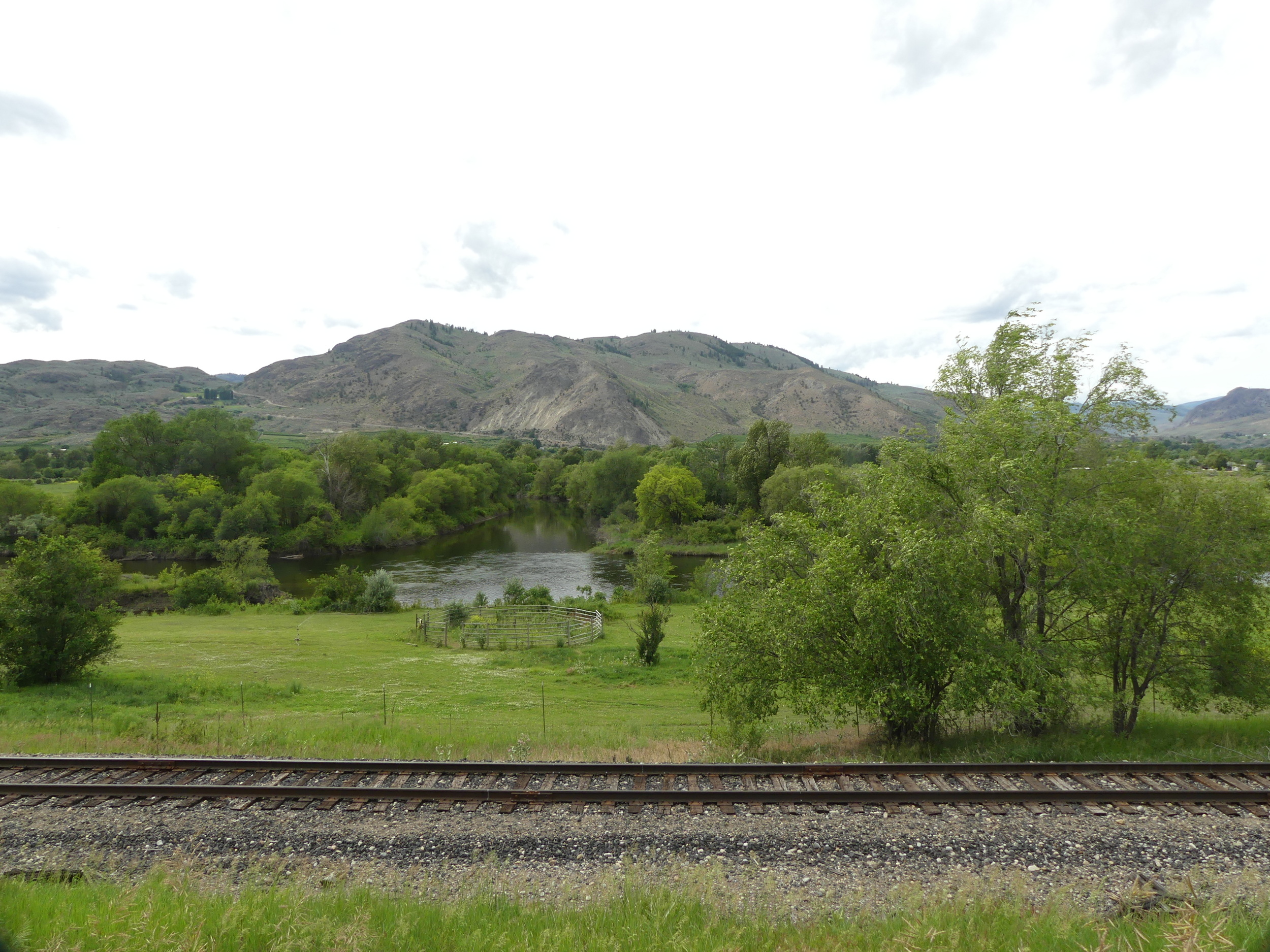


Three Smelqmex Villages at The Forks
There was a village at each side of the Similkameen and on the East side of the Okanogan (by the tracks in the first image). The Northwest Company and the Hudson’s Bay Company used the village (the green field now) across the Okanogan River, to the left of the Similkameen, as a horse camp. After 1859, it was a cattle camp, for cattle drives to the British Columbia gold fields in Baskerville.
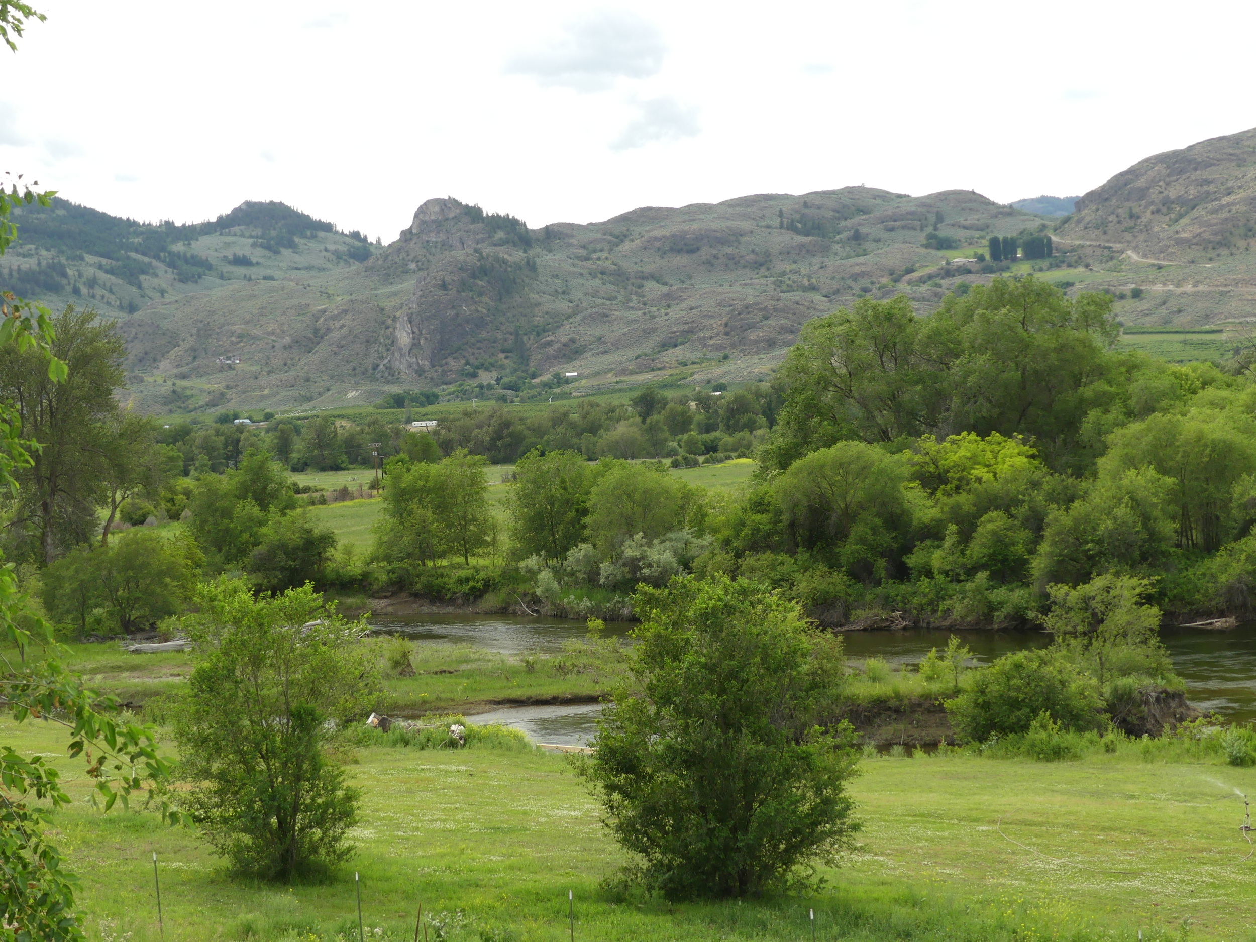
The Smelqmex now live in the Canadian camp. Those are profound changes. A people has been separated from many of its stories. Yes, stories. Look again.
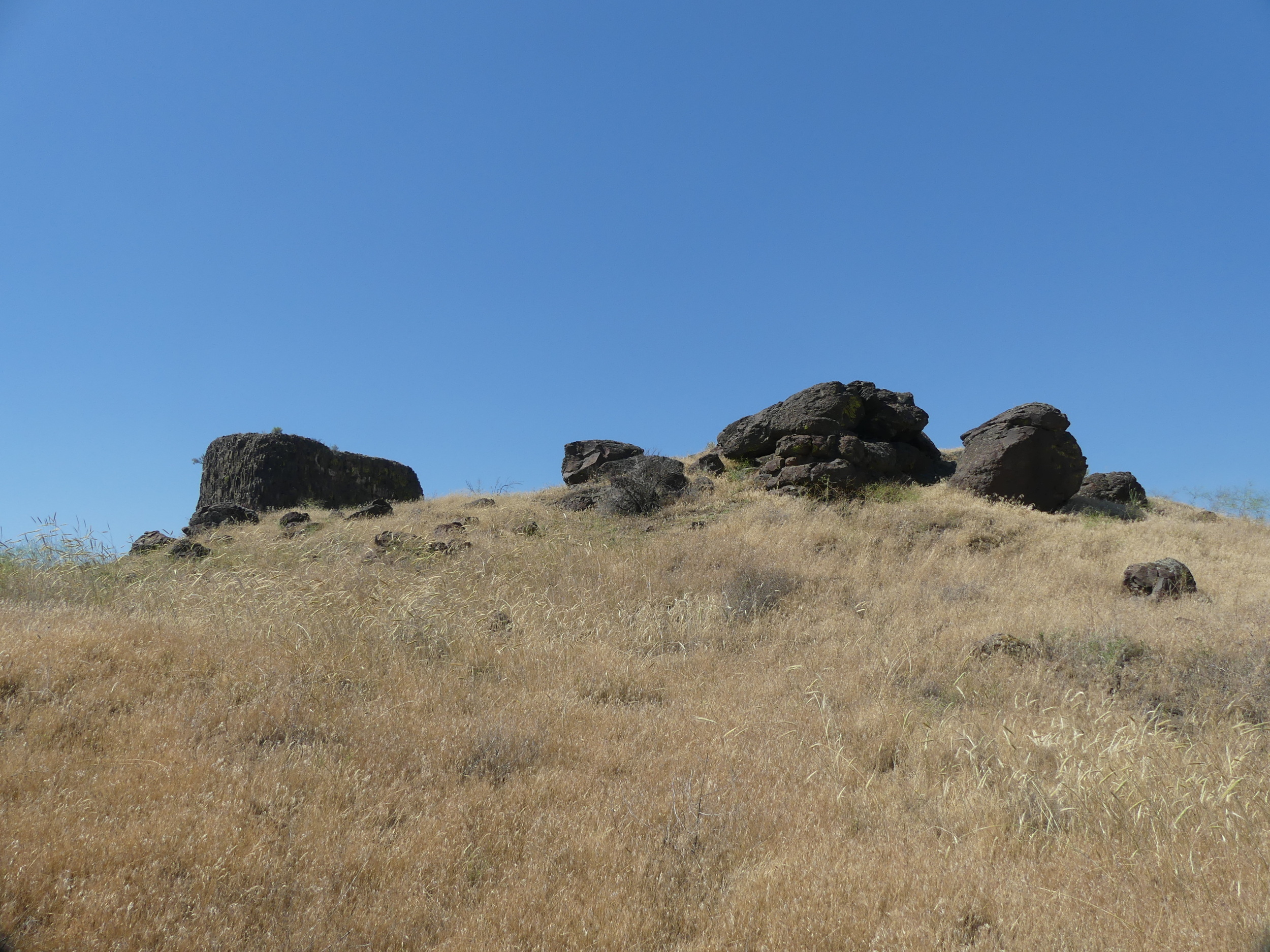
You are looking at three of them in this image. They look like a river gorge, a silt bluff and a mountain (Chopaka), but that’s because those are the terms that settlers described them as. When stories are as much titles to land ownership, or at least to responsibility to a particular environment, that is like setting one court and one intellectual system over another. Here is one of those systems, just over the hill, in the Canadian Camp.

kłlilx’w
“Since the dawn of history, Spotted Lake or “Ha? Ki lil xw” as we call it, has been a sacred place. Indians from all tribes came to visit the lake for the medicine the lake contains. The ceremonial cairns, too numerous to count that surround the lake testify to that. Some of these are so ancient they have sunk underground and only their tops remain above ground. Some are buried altogether. There are many stories told by our ancestors about the cures this lake has provided, physically and spiritually through its medicine powers.”
Statement of the Okanagan Tribal Chiefs on Spotted Lake
https://www.syilx.org/about-us/syilx-nation/spotted-lake-2/
As ancient and long-lived cultures, the cultures of the grasslands viewed the world in their own terms. The far younger civilization that met them — French, American, Canadian, English, Spanish and Russian — did so as well. We live today within this story. The Euroamericans came to trade for material profit, with prices dependent on supply and demand in Europe and China. The Oblate priest, Father Pandosy, who came from France but was allied with Jesuits from Quebec, tried to translate between sides in this collision. Interpretations, even oversimplifications, of his experience created such things as the town below:

Osoyoos, The Canadian Twin of the American Border Town of Oroville
So’yoos, the main syilx village on the lake, is to the left, and spilled over into the lagoon you see near the centre of the image. Hurley Peak, the twin to Chopaka, which you saw earlier, is in the far distance on the left. The highway (3) which you see in the centre of the image, leads to kłlilx’w (a bit past where you lose visual track of the highway.) The town is call Osoyoos because of an Irish joke.
Given that what you see here was created in the few years surrounding Pandosy’s arrival, a future for this land and her people 170 years in the future from today begins with the foundations we lay down now. Yes, I’m taking the long view, but when you are a son of the land, that’s what you do, or you become a slave to someone else’s story.
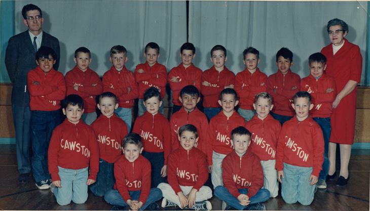
1967. I’m second from the right in the middle row.
This was the only time we were a team or used these uniforms. They made a photo and were then packed away. What this photo represents was what an isolated American-British version of Canada wanted of us, not what it gave. The goal, as I discussed earlier in this series, was to create a small town culture that would support manufacturing in Central Canada: a replacement of colonial dependance on Manchester and London with dependance on Toronto and Montreal. It helped the creation of a modern nation state, but did nothing to maintain the grassland of the valley.
The first Europeans on the western plateau were met with balances of power and respect, some of which were known as enslavement rituals. They simply do not appear to have see them. In July 1818, for example, Donald MacKenzie, Alexander Ross and 95 North West Company employees (38 Iroquois, 32 Hawaiians and 25 French-Canadians) built Fort Nez Percés.

Alexander Ross. Source
Their goal was to trade. The chosen site was a low bench on the shore of the Columbia River, just north of the Wallula Gap. It is a place where the river flows south, the wind north and the world turns to grass and stone and breath.
The home of the Liksiyu people, the People of the Rocks
Known to the French Canadians as the Cailloux (the People of the Rocks), they are commonly called the Cayuse now.
The colonial trading fort in the heart of their homeland of rock was called Fort Nez Percé, after the Nimíipu’u people, misnamed The Pierced Noses (Nez Percés) by French Canadians, even though they never pierced a thing. This is not Nimíipu’u territory. This is Wallula, at the mouth of the Walla Walla River. Its people are the Wallulas (The Walla Wallas, another degrading reduction, much like calling them the Blah Blah Blahs). Here, this should clear it up:
- The Wallula are Sinkiuse,
- who are Liksiyu,
- who are cousins of the Nimiipu’u,
- who are cousins of the Shoshone,
- who are cousins of the Liksiyu,
- who are cousins of the Yakama,
- who are cousins of the Wishram,
- who are cousins of the Umatilla,
- who are cousins of the Shoshone,
- who are cousins of the Liksiyu,
the rock people,
- who are cousins of the Touchets,
- who are also Wallula,
- who are children of
aka the rock people,
- and cousins of the Wanapums,
- who are the people of the

river (aka the N’chi’wana),
- and, thus, cousins of the Sinkiuse,
- who are the Wallula.
Maps, which separate relationships of union like that into geographical relationships and travel through geography alone, and reduce the river and its stories…

Wanapum Village Site in Hanford Reach
… to water, are less than helpful. Every year the Nimiipuu came down from the Blue Mountains to trade at the great bazaar of the Northwest, the Wishram fishery at Celilo Falls.

The Fishery, Flooded by The Dalles Dam
Looking East from the Trading Camp at Horsethief Butte
40,000 people came, from all corners of the world. Everything was available there: parrot feathers from Central America, obsidian from the West Chilcotin, rope from Penticton, mats from Moksie, powdered salmon in bentwood boxes from Wishram, horses from here, there and everywhere, buffalo hides from Blackfoot Country, ochre from the Tulameen, chert blades from Goldendale, blankets, furs, woven hats, the works. An annual shopping trip was just the thing.

The Butte at Wishram
Note how here at the heart of the fishery, the river and her stories are written in the rock itself.

Life Carries On Among the Rocks
Wishram
The Nimiipuu camped at Wallula, between the fish camps at the mouths of the Snake and the Yakima, and the fish camp at Celilo. Just to be clear, though: the whole region from the village at Beacon Rock, just below the Cascades (now under the Bonneville Dam), to the ford at Paxçu (today’s Pasco) was one nearly unbroken fish camp. The camp on the Yakima, for example, stretched from its confluence with the Columbia to Horn Rapids, five miles east. It covered the entire Tri-Cities region. It was a metropolis.

The Village at Beacon Rock is Still Inhabited
It was into this multi-species city in which even the rocks were people and humans and the land were each others’ stories, that MacKenzie and Ross set up their camp. It was like having a couple busloads of men in buckskin jackets move into downtown today and start setting up a military fort.

Kind of like this.
As there wasn’t any wood to knock the fort together with, they sent crews 100 miles up the Walla Walla River to cut it from the Blue Mountains — a Nimíipu’u homeland — and float it downstream: an old French-Canadian and Hawaiian skill.
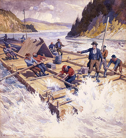
“The first lumber raft down the Ottawa river 1806” (watercolour by Charles William Jefferys, Library and Archives Canada, MIKAN No 2835241).
Friction was inevitable, as Ross reported in his 1855 memoir, The Fur Hunters of the Far West:
Soon after our landing the tribes began to muster rapidly; the multitudes which surrounded us became immense, and their movements alarming. They insisted on our paying for the timber we were collecting. They prohibited our hunting and fishing. They affixed an exorbitant price of their own to every article of trade, and they insulted any of the hands whom they met alone. Thus, they resolved to keep us in their power, and withhold supplies until their conditions were granted.
Alexander Ross: The Fur Hunters of the Far West
These look to me like the gestures of indigenous alliance-making through capture and release. The Canadians did not play along. Neither did they pay for the resources they used. It was a collision of legal systems. And how did that end up? Why, in a photo moment.

The Plutonium City on the Hanford Nuclear Reservation was divided on racial and class lines. The original three cities were divided between black workers, white workers, and a white management and scientific class. Richland, an old apple orchard, was reserved for the white management and scientific class. They are one city now, but some of all that stuck, just the same.
Perhaps in an effort to keep viewers from noticing that Tri-Cities is really four cities, Pasco, Kennewick, Richland and West Richland, the tourism site visittricities.com uses a banner of three young women as one of its leading images. Two are sitting in (Mahogany? Teak?) deck chairs. The third perhaps on a stool or bench. They are on a dock on the shore of the impounded Columbia River, with the green, irrigated lawn of Howard Amon Park behind them and the Kentucky sternwheeler dock in the near distance. Look closely. One wears cut-of jeans, aviator’s glasses and a straw hat. One wears a LA cap and a bikini top/denim overalls combo in the colours of the America flag, and lilac-rimmed sunglasses, perhaps to demonstrate that she is just passing through and this is a good place for that pan-global reach. One wears a straw hat and a sheer lace blouse decorated with roses. Her sunglasses are pink and blue. There is a tattoo. There is a clear glass of water. There is a lot of expensive dental work. There are three eyes between them, that the glasses don’t hide. All of these women are white. The colours of their glasses, bikini straps, tans, chairs and glasses all match the sunburst of coloured exclamation marks that make up the logo of this nuclear city.

This was well thought out.
Fortunately, the racial thing has been fixed.

Well, sort of. Look again at these beautiful winemakers. They really are beautiful:

This time, the photographer got carried away. What, exactly, is the symbolism of the wine-coloured dresses, the maid’s outfit, and the class nod to wine pressing by foot in the barrel?
And where are the people of the river? Ah, here:

That’s Huck Finn and His Sister, I think, at Kamiakin’s Fish Camp
Perhaps there’s work still to be done.
Before we leave this view of the future (from our feet on the ground in 1819), let’s just look a little further. The website promises: Hotels & Lodging, Food & Drink, Things to Do, Deals, Wine, and About. That “About” sounded pretty interesting, so I had a look.

Well worth the click-through, too!
So, that’s what we got, eventually, out of Mackenzie, Ross and their crew:
a bold yet casual, geeky but cool, magical experience in wide open spaces.
It doesn’t mention that in the winter, the Wallula wind blows north over the Hanford Nuclear Reservation, whipping dry snow across the road so thickly that it vanishes. You drive through a river moving over your tires from the southeast. You sit above it at the steering wheel, as the stars burn through the black sky overhead: a vast sheet of ice descending on the world. It also doesn’t mention any history at all. Not one little bit. Not even that the plutonium for the atomic bomb was produced here, with a workforce of 50,000 imported from the South. Isn’t that odd? Imagine, a country without history. A place for fantasy. Imagine how you would feel about that if you had lived here for 16,000 years? Or 12,000 here:
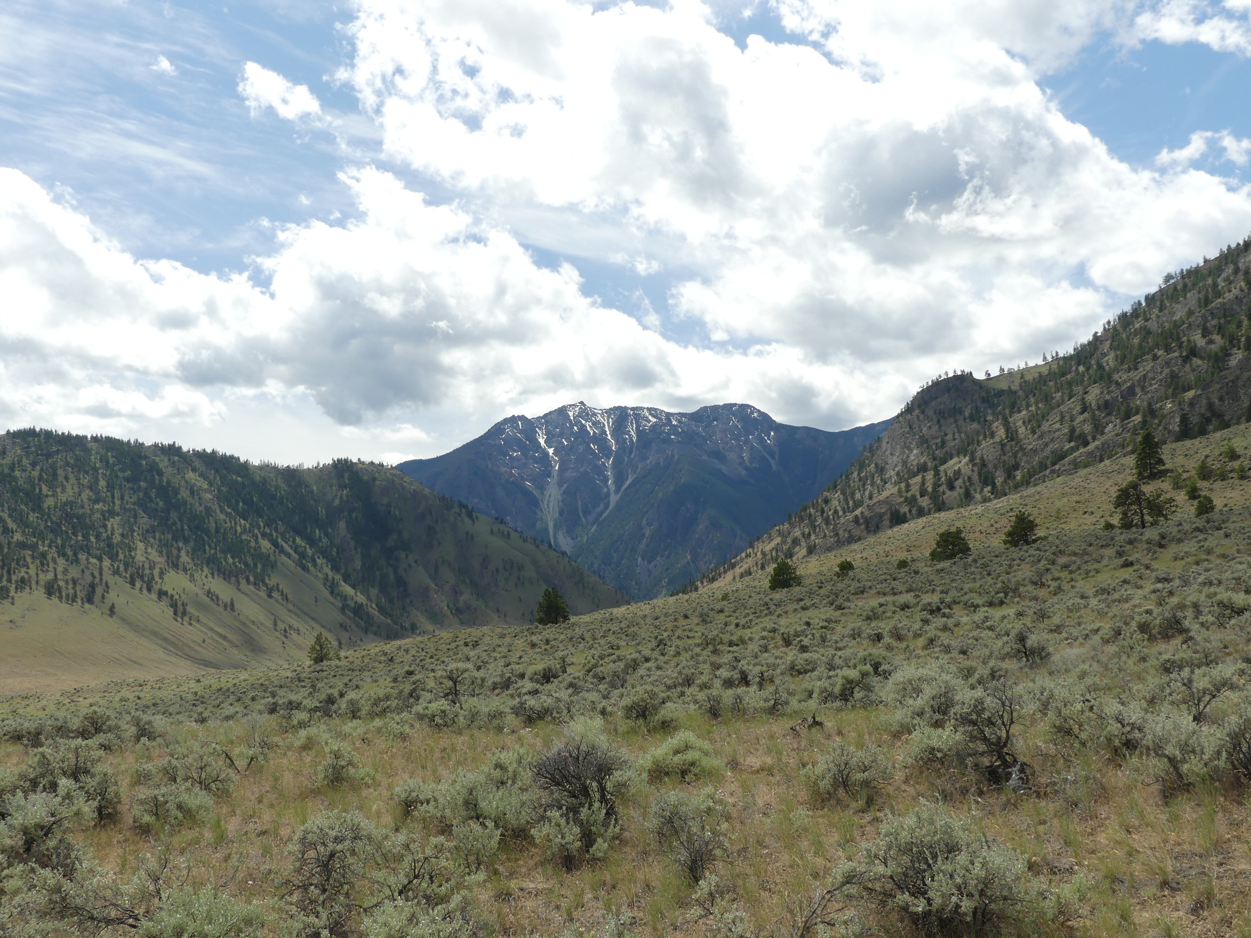
Chopaka, Near Nighthawk
I surmise that “Nighthawk, WA” is an English-speaking tongue getting tangled up with the name of the river, the Nkwentaiktwt.

The Nkwentaiktwt at Nighthawk
Note the grave.

There is history here. Even in Tri-Cities. There, Oyt.pa.ma.na.tit.tite, the Ancient One, was killed on the shore of the river around 9,000 years ago.
Kennewick Man and Ancient One are the names generally given to the skeletal remains of a prehistoricPaleoamerican man found on a bank of the Columbia River in Kennewick, Washington, on July 28, 1996.[1] It is one of the most complete ancient skeletons ever found. Radiocarbon testson bone have shown it to date from 8,900 to 9,000 calibrated years before present,[2][3] but it was not until 2013 that ancient DNA analysis techniques had improved enough to shed light on the remains.
https://en.wikipedia.org/wiki/Kennewick_Man
He is part of our story.

Let us tell all of it.
Categories: Earth, Ethics, First Peoples, Gaia, Geology, Grasslands, History, Land, Nature Photography, Other People, Pacific Northwest, Recreation, Spirit, Water


Thanks, Harold. Thought-provoking… decolonizing?… journeys, all. One point which does have some significance, not least of all in the spirit of your observations and investigation. The Richland lady in the “overall top”: it seems to me her beak cap is boasting – or certainly, suggesting – the team colors of baseball’s “Dodgers” along with the classic “LA” insignia. Not Iowa State: typically, “ISU” with its standard university colors of gold and dark red. This allusion to LA may in fact be a conscious attempt to dispel casually any widespread concern about tourist or urban-flight colonization among the ranks of older, established generations of “settler” populations. Recall Governor Tom McCall’s pithy promotion: “Come visit beautiful Oregon, then please, go home!” Or more recently: “Don’t Californicate Idaho.” Or anywhere else for that matter as so the slogan’s sentiment implies…
Best.
LikeLike
Thanks! I searched all over the web for caps and thought I had the right one. I’ll make the correction. That’s amazing info about urban flight colonization. I hadn’t heard that term. It certainly has ruined this valley. What I mean is that from a high degree of ecological care and awareness, we have gone to the lowest point ever, and the environment shows it. I was asked a few months ago, even, whether I identified with Indigenous people or with ‘us’? I was floored. What about everyone together in the land? Who knows what was meant, but I was shocked that we hadn’t got beyond that. We don’t get many Californians up this way, but a huge number of Canadians who come to experience Canada’s self-declared Napa Valley. Ha ha ha.
LikeLike
Ha-ha. You are welcome! Those “naming” issues are the stuff of cultural immersion. To clarify, south of the border, we say the State of Oregon, the State of Mississippi, etc. and not Oregon State, Mississippi State. Two exceptions. New York State, to distinguish it from New York City in print or conversation. Washington State, to distinguish it from the nation’s capital. In conversation, to be brief, “Something State” typically registers as “Something State University”. Thus, Ohio State is short for Ohio State University. These are also shortened to initials or acronyms, like OSU, which yes, can be confused with Oregon State University. Note: the state of confusion being a whole other gaggle of geese. In fact, it all seems reminiscent of the challenge of “naming” and categorizing in general, as we often come across when dealing with flora, fauna, etc. in scientific terms or common language. Ha-ha. Just the other day a friend raised the question of what “in fact” distinguishes a rabbit from a hare… I’ll leave it there.
Ah yes, tourist and urban-flight colonization. What goes around comes around, no? Not to mention, gentrification. You cannot believe how urbanites today in a city like Portland will distinguish their “place-based pedigree” by whether they “settled” here ten, twenty, or thirty years ago!! OMG… I’ll leave it there.
Do carry on. And thanks again.
LikeLike
Thanks for the nomenclature! Yes, I meant OSU, but it got garbled due to my ignorance. There were so many many hats to look at on so many many sites, I got dizzy. I don’t understand uniforms of that kind. This just marks me as the son of a postwar German refugee, a war kid, that’s all. One odd thing about the Okanagan Valley here in BC and place-based-pedigree, is that only settlers who have come in the last 20 years are part of the culture. Any others, or ones born here, are not. Too funny. The changes are understandable. The exclusion is just plain strange. But so it is when humans come to the feast!
LikeLike