


Northern Cascadia has vast amounts of land and water, yet both are too expensive for the people who live there. That’s one way of putting things. Another is that land and water are mixing in front of us.

Forest and cloud mixed by fire on the Cariboo Plateau
In official Cascadian culture, water, air and land are called resources.
Salmon Creek, Conconully
Fire is not culturally considered a resource. It is culturally viewed as a catastrophe. Not because it removes land and water, but because it destroys values assigned to land and water, which are where people really live. Things like a certain notion of beauty, certain forms of paid labour, and a certain sense of what is valuable, such as trees.

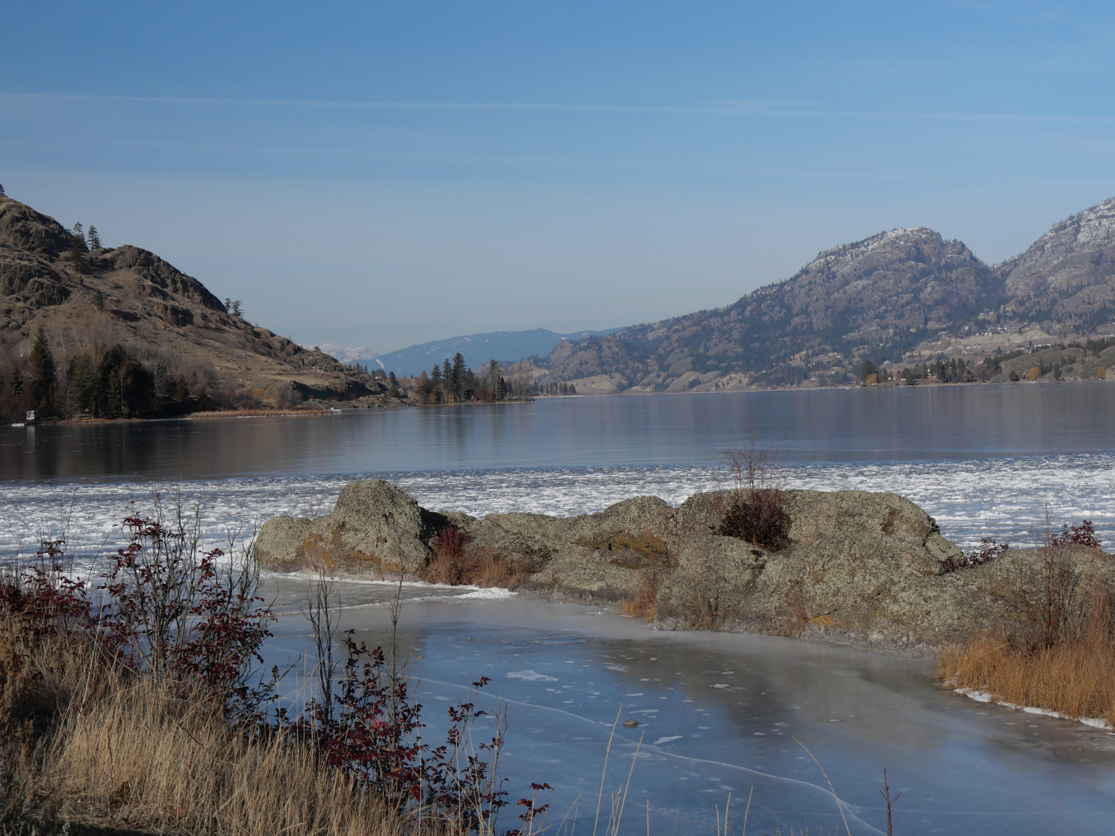
North Aberdeen Plateau
Mind you, it’s not the trees that are valuable. If they were, they wouldn’t be cut down.
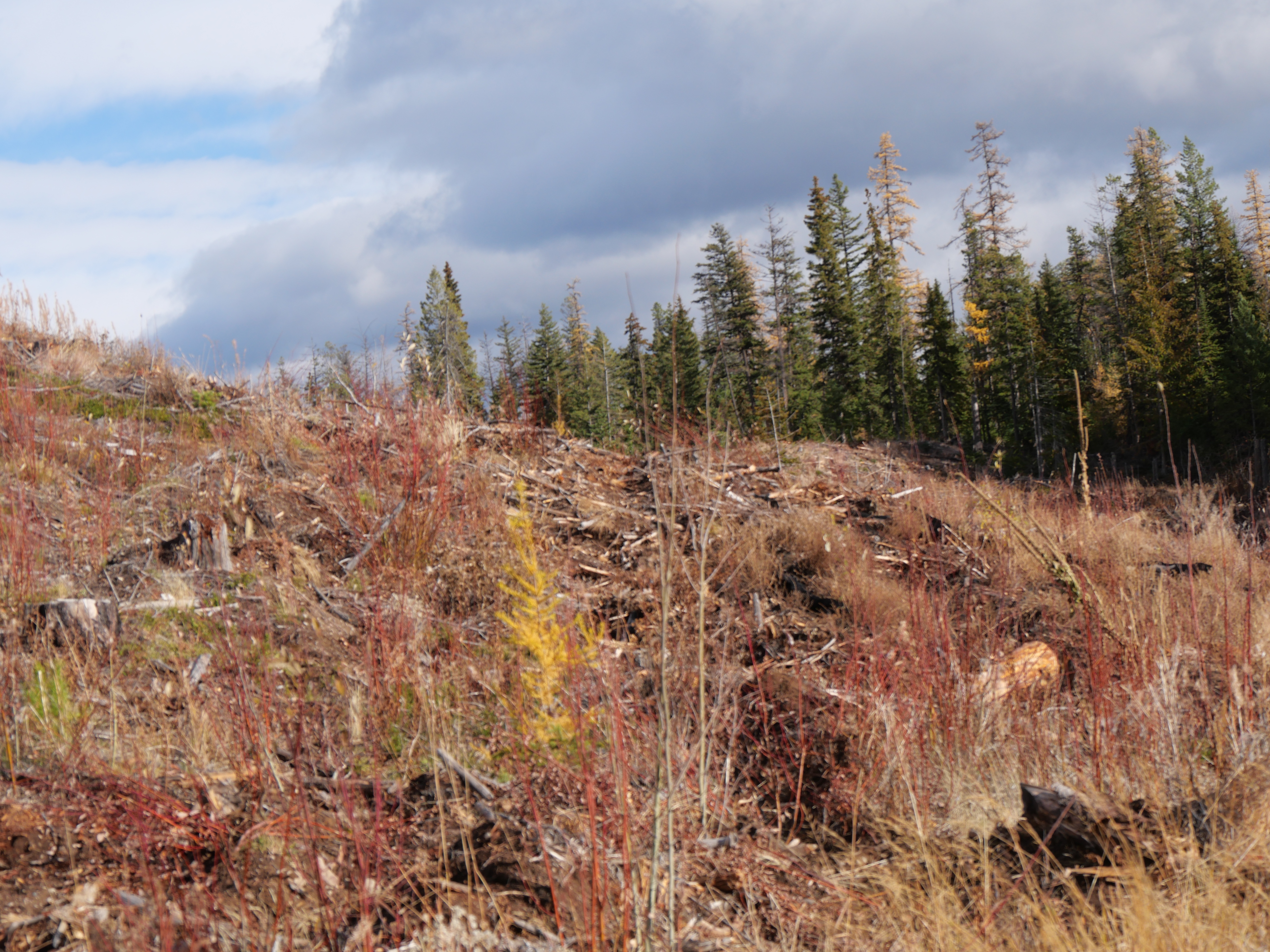
Clear Cut in a Watershed in the North Aberdeen Plateau. The narrow band of trees on the right is there to protect the drinking water of the City of Vernon from this “mixed use” land-use procedure.
It is worth remembering that since Euro-American rule of Northern Cascadia, since, that is, 1858, and in Southern Cascadia a decade earlier, in areas populated by fire forests, there are somewhere between 100 and 1000 times as many trees as there were when Europeans came. As an illustration, here’s an image of the Hudson’s Bay Company Fur Brigade Trail in the central Okanagan Valley. Note that not one of these trees was here a century ago.

The trees will burn. In other words, trees are an investment, but if you don’t cut them down, and keep them for, say, beauty, then fire gets them!
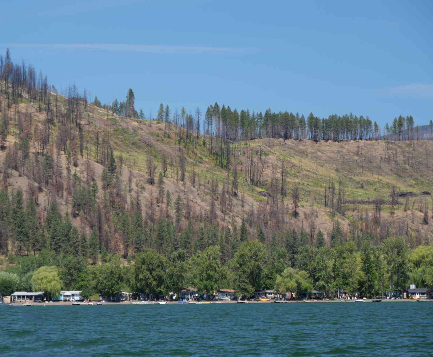
The shore of kɬúsx̌nítkʷ near Head of the Lake. These holiday cabins are on land leased from the Okanagan Indian Band.
What a headache.

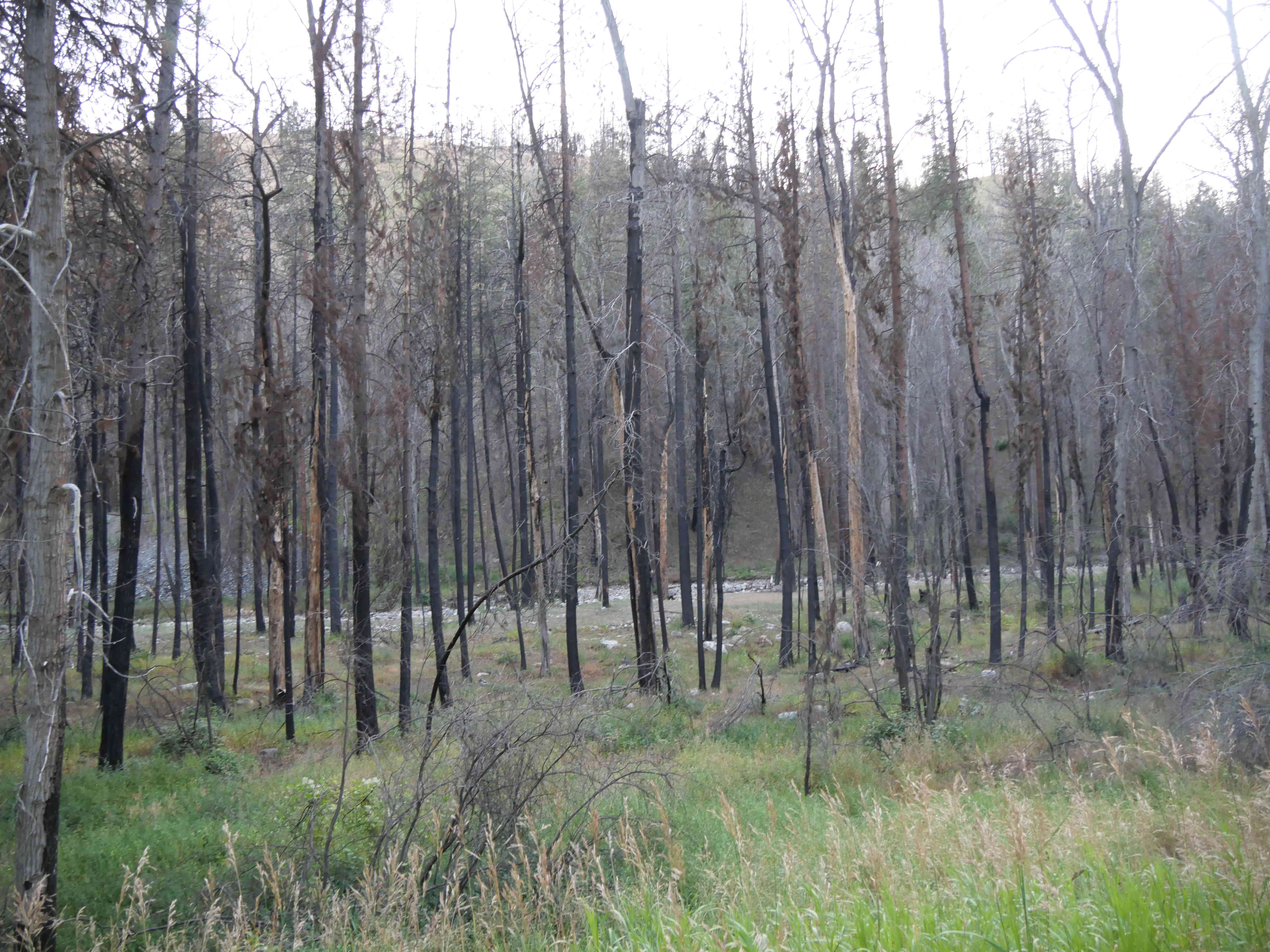
Spruce in the Stswecem’c Xget’tem Illahie, being vulnerable.
Let’s not forget, though, that land and water are not separate.
One of the original outflow channels of T’wcin at sx̌ʷəx̌ʷnitkʷ, now a pond (there is a dam), with trails for enjoying “nature.”
Another point: the land and the water and the people are not separate. This is part of the complex called “The Little Falls”, one of the two salmon fisheries of the syilx nation. Every rock here, every animal form in the rock, has a story. Together, they have another story: the story of cultural erasure through “flood control” (a dam), “irrigation” (for colonial agriculture), and the creation of a British nation within the braid of syilx land and water (British Columbia.) Don’t worry. It’s no different in southern Cascadia:

Lone Pine Replacement Fishery Staring Down The Dalles Dam on the N’chi’wan’a below drowned Celillo Falls
In this conception, nature is as much a resource as land and water. Something to be used, a residual value, like money in the bank (or water behind a dam), that can produce dividends (power, whether to light houses or power over other people). This realignment of land, water and people began in British Columbia in 1858. Hereabouts:

The Fraser River Above Hill’s Bar
A few miles of river, anchored here and at Yale, just to the left, housed 30,000 Californians in 1858. They were here for various reasons. Some to found an independent republic. Most to repeat the California Gold Rush of a decade earlier.

Sarah Crease’s 1862 image of Hill’s Bar, After the Excitement Had Passed. Source.
Note the wooden water flume.
For three months, this river valley was the site of a war. 3,000 Nlaka’pamux people died. Machine guns were set up on the trails and mowed them down. By the time the British gained control, the land and water and people had been separated. The Nlaka’pamux were on reserves. The water was divided on first use principles imported from California, where they had developed informally as part of a system of gunfights and honour. The land was divided into claims. The government, when it showed up, could only serve to keep the system running smoothly, without violence between claimants. Violence against the Nlaka’pamux, the Secwepemc and the Syilx was guaranteed, because for the rest of the system to work they had to be separated from their land-water-human bonds, including in places like Chapman’s Bar (the main nlaka’pamux fishery)…

Chapman’s Bar is the triangle of white gravel on the east bank of the river, mid-image. It was largely infilled to build the Canadian Pacific Railroad, that bound a bankrupt British Columbia to Canada, as part of a deal that included clearing the colony’s debt.
… and sx̌ʷəx̌ʷnitkʷ:

Note the Sexual Imagery. All people. Not all human.
Separately, they could be managed (or mismanaged) by separate government departments, in the same way that universities are arranged around separate departments. For example, in the Canadian university laid down in the syilx illahie, the physical world looks like this:

While the social world looks like this:

Neither of them is a place for human expression. That is a place for analysis and the practical application of the areas above. You can see it here, within the community of other departments managing the separations.

There’s a lot of good work going on in all of these departments, by devoted and intelligent people applying powerful tools of research and analysis bound with strong traditions of practical application, but at the end of the day the land and water are unaffordable to the people of Northern Cascadia, after 167 years of this approach. That’s because at Hill’s Bar it was all never meant to be affordable. Still, despite the impoverishment of the environment through drought and its vulnerability through replacement with fire forests, as well as the separation of people from both, the opportunity of contact with earth and water remains

Smoke, land and water at the Big Bar Lake Boat Launch.
It is our work now to put the pieces back together.

Loon, diving. Big Bar Lake.
Categories: Cascadia, Erosion, Ethics, fire, First Peoples, Forestry, Geology, Grasslands, History, history, Industry, invasive species, logging, Nature Photography, Other People, Pacific Northwest, Recreation, Spirit, Water


