


The Government of British Columbia says that Kickininee …

The Government’s Image of Kickininee
…and its other points in Southern Okanagan Lake isolated by Highway 97 have no historical value, only recreational value (swimming and boating for Penticton and Summerland residents). Well, here’s the view from Kickininee.

Close up?

Closer?

Hmmm. And as for the name:

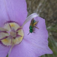
Kickininee, aka Kokanee, aka Land-locked Sockeye Salmon. The Redfish of the salmon people.
https://animaldiversity.org/accounts/Oncorhynchus_nerka/
And as for the location, there are four small points in Okanagan Lake here, separated by shallow bays, to the south of the ancestral spawning stream of Trout Creek:

Have a closer look:

Forget the map’s mistake, placing Vaseaux Lake here. That’s an administrative term, and an indication of the degree of intelligence within Artificial Intelligence. The bottom point used to be one of the two main whitefishing points on the lake, before Highway 97 destroyed the water flows by filling in the bays. The next point to the north is Kickininee, or Redfish point. It has a gravel beach. The whole lake has a gravel beach, although much of that has been filled in with imported orange sand. You can just make out the old lakeshore bays south surrounding these points, all of them protected by weather, and all still, despite all rockfill, still attracting loons, who hunt small fish. What’s more, this area was part of the original 1859 Penticton Indian Band Reserve, and included the town of Summerland, or Nkwala’s Prairie, one of the main settlement points on the lake.The land above Trout Creek was removed from the reservation to provide space for the Summerland Agricultural Research Station, a colonial institution designed to foster the replacement of traditional land use with European farming. The point mislabelled “Vaseaux Lake Provincial Park” above is Soorimpt, named after Chief Soorimpt of the Penticton Indian Band.

Soorimpt’s legacy is a highway that obliterated the ecology of some of the most productive shoreline of Okanagan Lake. So, when the Provincial Government says in their Purpose Statement and Zoning Plan:

Did you see that? Look more closely at culture and history:

Blank. Well, that’s the kind of government it is. Not only is it unaware, but so are its managers. I’m stumped as to how that can even be called a government. The British Columbia Government defines the “Colonial Period” as the time span between 1849 and 1871, but how can that be if in 2003, when this report was filed, there was still no non-colonial history (and precious little recorded of that, even) in this place? It’s shameful.
Categories: Ethics, First Peoples, History, Recreation, Spirit, Water


It’s always a sad day when the gov tries to take care of nature.
LikeLike
sadly, yes
>
LikeLike
It makes respectful sense, I think, not to tell, but to ask people about matters like the one here. Start with those for whom it has been home for a long, long time, and then those like you and others who are can produce blog posts like this one.
Incidentally, I find that my natural tendency is to do some searching, and then TELL others what things are about. I’m trying, with some success, to say, “Who lives there? What do you know and experience of which I am ignorant? Could you inform me?”
LikeLike
Thank your for your research and explanation!
LikeLike
Thanks. It’s funny. We have a university in this valley, but it’s not changing the game.
>
LikeLike