


This week, I’d like to look at how we might extend the notion of map-making to read the environment in ways that release opportunities that are currently blocked by contemporary maps. In one sense, a map is a track. The map below is not only an image of a moment in space, but also a track of time.

Sun has eroded the coyote tracks at left, while the newer tracks at right are set into newer snow and then elevated when wind stripped away the loose snow around them. Many dimensions of time are present. There is the time between each coyote footprint, the time between the beginning of each track and its end, the time between the laying of each track, and the time after the laying of the new one. There is also a relationship between these moments of time, which is also a form of time. This one is called consciousness. It views the moment in space above as a moment in time. Both views are available to us at once. Below are some human footprints showing the same pattern. As there is more distance in the image, there is both more space and more time.

A track across space and time, in a representation in which they are both present at once in consciousness? That’s enough for any map. That being said, this is the kind of map we have to deal with instead:

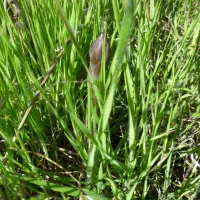
Notice how this “map” is a guide not to space but to businesses and the legacy roads that connect them. You can, however, still use the map in an older sense, to plan a track across space and to locate yourself relationally within it. (The human footprints above, for instance, are pretty much right above “Fitness Studio”.) Revealingly, every action of using the map in this way reaffirms colonial space by situating us within a colonial grid rather than the land itself. It’s useful, for sure, but it relegates all other views and activities to the dominance of this one and the forms of thinking it represents. That kind of preference for a certain form of analytical thinking is dominant in Canada and the United States today, but if you think about it, the footsteps at the estuary of Vernon Creek (the lakeshore at “Dump Runz” above)…

… are as much about story as place. Sure, we can fit it into the “map” above, but that subordinates story to mapping. It says that society is made out of the map, while story is individual and a subset of the map. What if that were a misinterpretation, though? What if this were the map?

What if the image below (the industrial, social, urban colonial grid) …

… was secondary? Would that more accurately reflect both lived experience but also the sense of political orientation to government represented by contemporary popular suffrage, including issues of indigenous identity? Would not a new kind of map allow for an end to the political disconnect that plagues the grid-state called Canada (not to mention the other grid state to the south)? This week, I will be applying some principles from literary reading, where a host of new skills have been developed, largely under-the-radar, to the mapping of land, space (physical and social) and time, to explore this important question. I hope you will join in.
Categories: Arts, Ethics, First Peoples, Grasslands, Industry, Nature Photography, Water


So interesting: space evolving/expanding in/through time…
LikeLiked by 1 person
I look forward to seeing how we might map that.
>
LikeLiked by 1 person
Long comment and question. . .
Me: I wonder if taxonomically chickadees are closely related to corvids. Are there any changes in taxonomy that relate?
FYI, former Smithers resident, Kelly Shepherd, has received strong reviews for his recently-published book of poems called Insomnia Bird, which features magpies and Edmonton. Magpie functions much as coyote does as a trickster. He receives lots of questions about why he featured mapgies as characters and images in his book. (Harold, I know that you helped with the creation of this book.)(
Reply: To my knowledge corvids (ravens) and chickadees are not close taxonomically. If you type in ‘Taxonomic relationships in birds’ in Google and go to the Wikipedia account you can follow links for different infraorders, suborders, orders etc. From that I see Corvidae are in a very different part of the taxonomic arrangement to the Passeriformes to which chickadees belong. Why do you ask?
Me: I’m asking about this because of a comment I read that used chickadees as the opposite of ravens, literarily. In my view, they are very similar. A grey jay seems to me by habitat and especially behavior, as a chickadee writ large. There is some movement about in saying the Linnean (sp?) taxonomy may be augment, improved (whatever) by behavioural rather than structural similarities. The topic is too complicated for my chickadee mind, but sounds promising.
Harold, it seem to me that the conversation above is sort of parallel to what you are asking about maps. I am open to this way of thinking because of that book I mentioned once: Saving the Appearances by Owen Barfield.
LikeLike
Hey, thanks! Great reminder. I bought that book on your recommendation and found it most stimulating. Something to work in as I go! Thanks!
>
LikeLike
Space, time and attributes can be mapped using GIS.
LikeLike
Indeed. I have something more elemental in mind. A different starting perspective.
>
LikeLike
Attributes can be poetic, visual or anything that can be imagined.
LikeLike
Yes, a beautiful explication of the power of Western culture. However, this is an experiment at getting out of Western cultural perspectives here, to see what can be revealed. Why not!
>
LikeLike