


This is pretty cool. It’s the Carte Des Nouvelles Decouvertes Au Nord de la Mer de Sud, Tant a l’Est de la Siberie et du Kamtchatcka, Qu’a l’Ouest de la Nouvelle France, drawn by Joseph Nicholas De L’Isle and Philippe Buache in Paris in 1752.
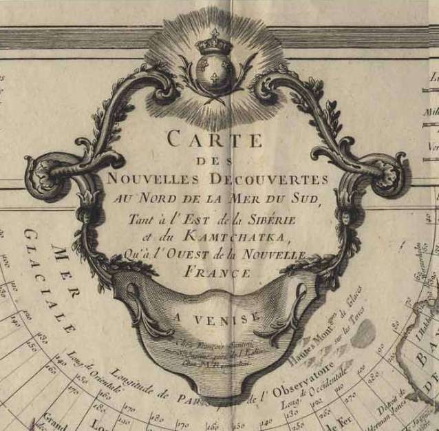
There is no record of Europeans having been here to draw a map, but what the heck, here it is. This map is centred on the North Pacific.

Here’s the North American half of it.

See that? That inland sea, the Mer (ou Baye) de l’Ouest?

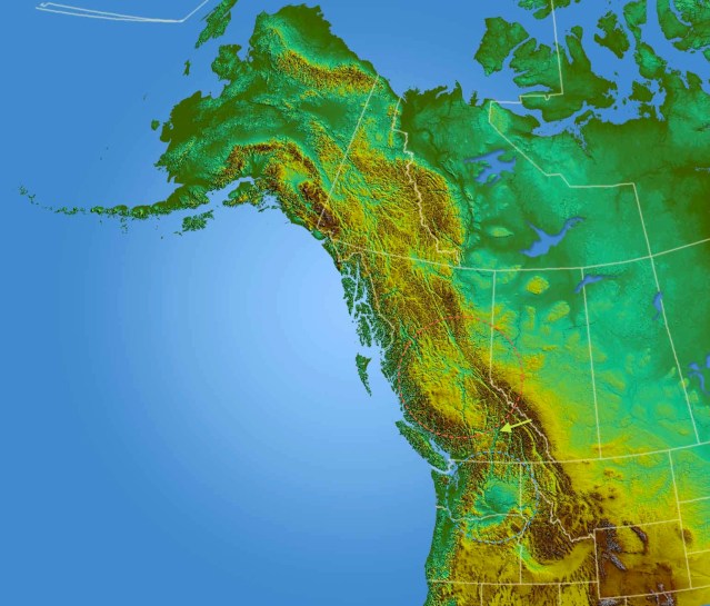
Whatever information the map-makers were working from, they have the rudiments of Vancouver Island, bits and pieces of the Columbia and Fraser Rivers, broken and not always in the right place, and this mysterious sea. Here’s the country today.
The Pacific Northwest and the Western North
Red Circle: Chilcotin Basalt; Blue Circle: Columbia Basalt; Green Arrow: Home Sweet Home
The Mer de l’Ouest precisely lies on top of the Chilcotin Basalt, a plateau of flood basalts in the centre of British Columbia, matched by the larger Columbia Basalt in today’s Washington State. Both are related to the arcs of volcanoes along the coast. Here’s the map of the Sea of the West again.
Now, much of this land was covered in water at the end of the last ice age, 12,000 years ago, in large meltwater seas following and spilling over the valleys. The four islands on the map could very well have been prominent orientation points. Intriguingly, they correspond very closely to secwepemc territory, centred on today’s city of Kamloops.

Secwepemc Nation
What’s more, this sea pretty much fits to the ancient span of the grasslands at the north of the Columbia Plateau and the eastern half of the Chilcotin Basalt. This is the traditional home of the plateau peoples.

Is that not our Sea of the West?
A sea of ice that became a sea of grass, with four peaks, islands on the map, marking the boundaries of Secwepemc territory? Who talked to these mapmakers? How old do these memories go? 12,000 years?
Categories: First Peoples, Grasslands, History


Fascinating research and insight, as always…it certainly makes one wonder about the information sources Joseph Nicholas De L’Isle and Philippe Buache had to draw from in their mapping.
LikeLike
And who they asked, what question came through the translation, what question was heard, and what question was answered. I’m going to keep snooping. Let’s hope I find something.
LikeLike