


So, let’s add something important to the history of Cascadia, the bioregion known in humanist tradition as The Pacific Northwest. This stuff:

The Central Cascadian Coast, with Fires from its Fire Forests to the East
This, too:
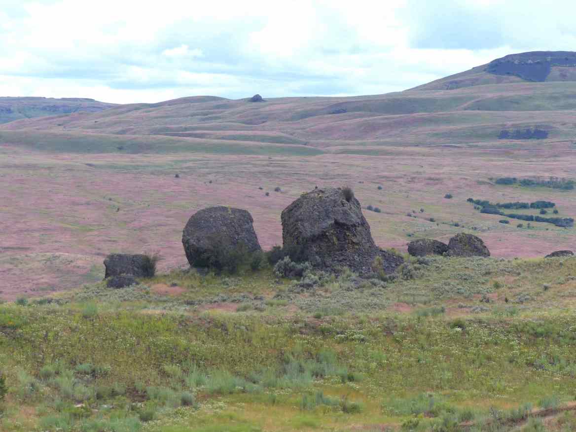
Coyote Rocks Near Lone Pine, Colville Nation
The red cheatgrass in the background, almost universally spread by cattle before 1871, is another form of fire.
If I am going to speak with the land, with her as an actor in human histories, it’s respectful to say who I am. A man, yes, but also a valley speaking. And that’s complicated. I came to life among scorpions in the Interior grasslands and, in the culture of industrial irrigation that replaced them, among Macintosh apples and Bartlett pears. Both legacies are mine. In one sense, the intermingling created sustainability on a land bankrupted by cattle. In another sense, it mixed both high country (with water) and low country (with heat) in ways which made the high country wild and a source of resources and the low country settled and a source of capital. Neither are the voice of the land, but both contain a little of it. This is a little closer:
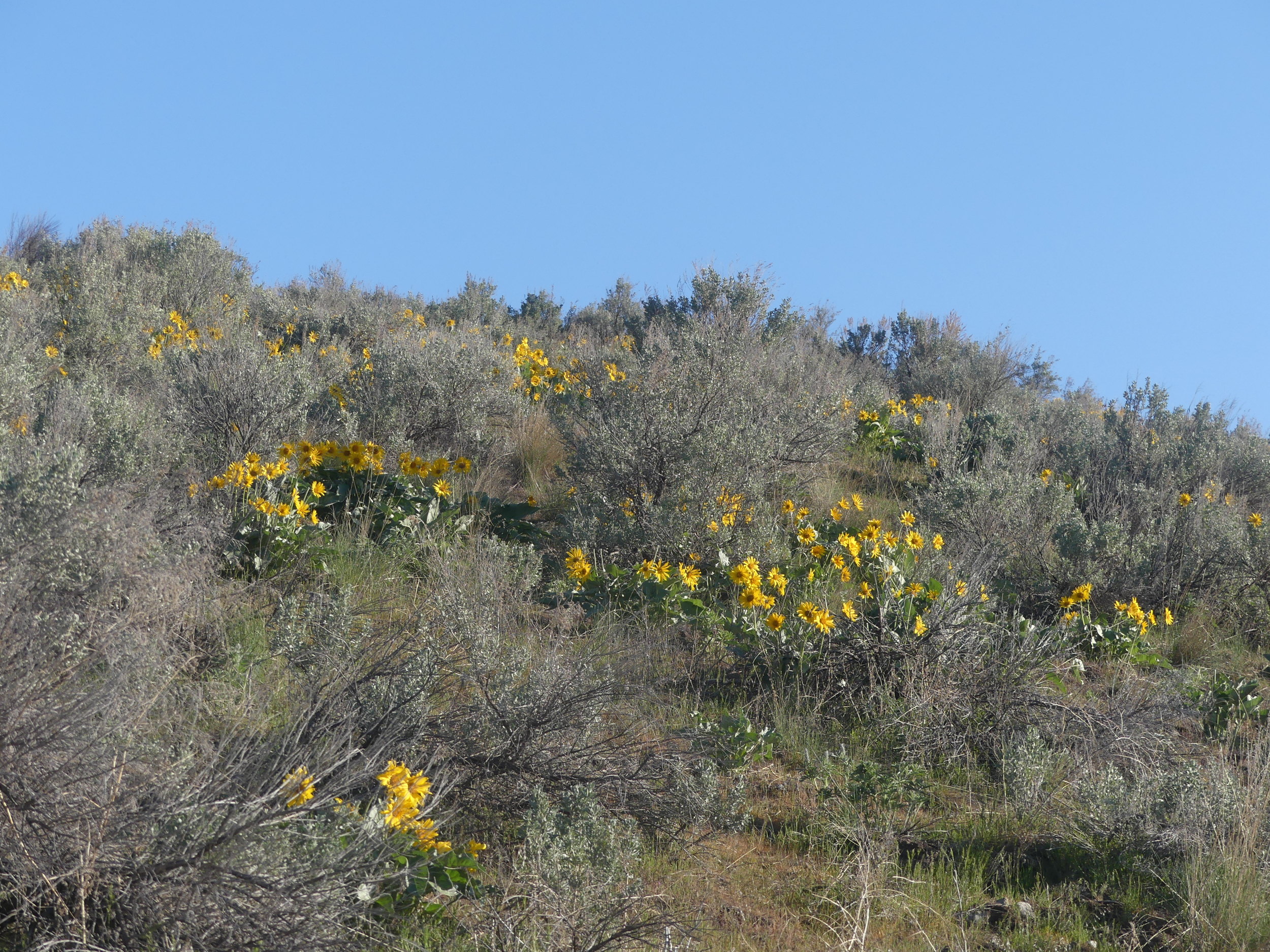
The sagebrush that delivers water to asters and arrow-leafed balsamroot (the mountain sunflowers above) is just one species that holds water on dry slopes through long parched summers. Without sagebrush, no flowers. Without flowers, no beetles. Without beetles, no birds. Without birds, no sagebrush seeds scattered, no deer trails and no soil renewal for more plants, beetles, birds, flowers, deer and people.
Perhaps if you come from outside of this place, from Canada or Germany, you can tell a story of building a country out of a wilderness, even make the everyday boast of irrigating a desert and turning it into the Garden of Eden. That story has been dealt out around here for 150 years. When you’re of this place, though, and a coyote calls from the hills as you’re picking a peach to eat in the dark while wind tears your hair up to the stars, peach leaves rustle around you like rattlesnakes and a bear woofs beside you from his own peach tree, it’s you that’s calling, you that it’s calling through, and you that’s listening. For that, White history is a distraction and an imprisonment. However, to be realistic, it is also so dominant that it is valuable to lay it out clearly in the frame of the land, so it can be identified and integrated into the real history of this place, which includes this:

Weed-poisoned purslane among crushed gravel laid over plastic cloth in a churchyard in the Commonage, land set aside150 years ago to be shared by both Syilx and Settler people. An Earth without life.
In contrast to such rigid notions of ownership, settlement and obediance, the land I am woven into is a braid. On one level, its braids meet at the intersection of the old Okanogan Trail (south to the salmon fishery at Celilo Falls on the Columbia and north to the shield volcanoes of the Chilcotin), and the old Takaetkun Trail (west to the Nicola Valley and east to the Rocky Mountains,) the root-gathering grounds of the North Okanagan, Turtle Mountain.

Turtle Mountain: an old story of village life that stresses the power of community as individual strength.
On a second level, the land’s braids are woven out of dogbane, a tall, dark reed which grows on the thighs of wetlands. The people of this grass, the syilx, take their name from weaving the stalks of this reed (and from their woven cosmologies and an interwoven land). When it is dried, dogbane cracks in the hand in honour of the four sacred directions, such as the trails spreading from my house. Once the pith (or bone) of the stalks is removed, their fibers (skins) are twisted by fingers, away from the core. The twisted threads are wrapped backwards against that energy, around each other, then are twisted and wrapped again, and again. The result is a tightly-woven, waterproof cord, shaped on the thighs of women. Traditionally, it was used to draw fish out of the water.

Dogbane (Indian Hemp) at Canoe Bay
The syilx traded this cord to nlaka’pamux fishers at Chapman’s Bar on the Fraser River, and to wishram fishers at Celilo. Frank Richter’s son, the syilx cowboy Hans Richter, had a lassoo made from dogbane cord, and used it in the rodeo ring and outside of it.

Chapman’s Bar (Middle Left)
The braiding goes far beyond cordage. The name “syilx” is built out of the root “yil,” which is a weaving, the self-directed command for responsibility, “x”, and the tag that this is a name, a way of being in the world, “s.” They come together into a name: “those who have the responsibility to weave together all things in the world;” or just “the weavers.” In the syilx conception, to be human is to create a landscape with the greatest diversity of species (peoples), ensuring that all of them have what they need to prosper; humans (among others, the weavers of this landscape), will prosper at the intersections of their energies. If you, a human, walk through the grassland even today, through blue bunch wheatgrass, sty?i, it will sing along your thighs with its name: sty?i.

sty?i
It only says its name when engaged in conversation with your body, spoken by the plant in that moment and you in mind and memory.
The land, its names and its people are one braid in one conversation. This land at the heart of Cascadia got its name, Okanogan, from two possible sources. One comes from Head of the Lake village, at the north end of Okanagan Lake, traditionally called s’ookanhkchinx, or “transport towards the head [top end]”, or, in contemporary terms “the road,” “the passage,” “the trail,” “the ford,” or “the road to the upper country.” The other comes from sqeliz territory, near Spokane. When the English mapmaker David Thompson came through the Flathead Country in 1809, he set up the first fur trade fort west of the Rocky Mountains, Kalispel House. On a subsequent trip in 1811, he made an expedition to Shonitku, or Kettle Falls. Next to Celilo Falls, it was the greatest fishery and cultural centre on the great river of the West. One of the men at the falls that day was a syilx man, at the extreme west of syilx territory, in all likelihood Chief Pelkamu’lox, whose son Hwistesmetxe’qen (commonly known to White culture as Nkwala, or Nicola) would be faced with the delicate matter of administering justice to a genocidal group in the invasion of gold miners out of Oregon in 1859. At that point, one of Thompson’s Iroquois boatmen, one of the six Iroquois named Legace (to indicate that he was baptised) who left his employ in the Bitterroot Valley and stayed on, had told him that the syilx man was one of the weavers, an accurate cultural and linguistic description. Rope was the major trade article of the syilx, and invaluable for fishers, such as those at Kettle Falls. It is entirely plausible that one of these boatmen was Anishanabe and told his employer that this man was a weaver, an “okaadenige” in Anishinaabenowi, the ojibwe language in which a braid is an “okaadenigan.” If this is the case, “Okanagan” is a colonial name, given from a continental wide indigenous culture: the indigenous fur traders who preceded, and then helped, the European fur traders and explorers of the 18th and 19th centuries, yet an accurate and respectful translation.

Kettle Falls on the Nkwentikwt, the Great River of the West
The land is also braided with people. The syilx of Head of the Lake village have been keeping a claim to the Commonage open since 1893. For twenty years before that, the land was a grazing reserve shared equally by syilx and settler ranchers, with the provision that if the land ever ceased to be common pasturage it would become exclusively syilx. It would not be sold off. The stipulation was insisted upon because before those twenty years of shared use the land was a reserve exclusively for the syilx. As the last land remaining after all the other land in the North Okanagan had been claimed, often illegally, by the area’s ranchers, it had become precious to both groups.

The Commonage, looking north from the summer village at the intersection of the ancient east-west trail between the Nicola and Shuswap Falls (a shared Syilx and Secwepemc Fishery in the Monashee Mountains) and the north-south trail between Fountain (a Lil’wat, Nlaka’pamux and Secwepemc fishery on the Middle Fraser) and Celilo. Today’s Silver Star Mountain ski hill is behind to the right.
The pressure was created by the judicial and administrative system of the colonial period, in which settler claims to land were accepted before the date at which Indian Reserves were to be settled — that is, before settler claims were to be allowed at all. This pressure led to the privatization of the Commonage in 1890, on the argument that the common pasturage the land provided was essential for maintaining the economy of the Province of British Columbia, which was funded by taxes on private property. Common property, such as the Commonage, could have just as easily supported a non-taxable economy, but by definition an economy like that would destroy the economy of the Province of British Columbia, which was its opposite: not a common economy but the privatization of one.

Cattle Trail and Erosion in the Commonage
The Commonage was a prize in this racialized economy because the scheme of turning land into money had a problem: cattle ranching was destroying the grass that its cattle depended on. Each year, more cattle grazed more grass down to dust. Each year, ranchers needed more grass to replace grass their cattle had destroyed; since all they had was dust, they needed more land with more ungrazed grass on it instead. Their cattle could then graze that down to dust. Then they would need more land, with more grass, just to stand economically in the same place they were in before.

Bunch Grass Grassland in the Chilcotin, Without Cattle
Here’s how the procedure worked: under the British Columbia Lands Act of 1870 any non-Indigenous farmer could purchase 320 acres from Queen Victoria for $1 per acre, plus an additional acreage of up to 640 acres for a variable rate from $1 to $5 per acre. One had to be wealthy to do so. That was the point. Incorporation with Canada in 1871 brought a different vision of settlement. The (Canadian) Dominion Lands Act of 1871 slashed the price to a $20 registration fee for 320 acres of Indigenous land. Wealth was no longer a prerequisite: even poor farmers were welcome. The British Columbia Lands act of 1874 discounted the price further: 320 acres of Indigenous Land for a $2 registration fee. When that grass was eaten down, cattle were moved into high country forests on leases of up to 100,000 acres at 1 cent per acre. The bias for industrialization in this model meant that most of the land settled by poor farmers was steadily consolidated into ever larger ranches as the original British Columbian desire for a landed gentry absorbed the Canadian strategy of erasing it with a wave of settlement.

The Commonage
A grassland of hundreds of species reduced to two by the extraction of syilx values and their sale as ground beef and rump roasts: a short-term strategy long past its best before date.
Predictably, disaster struck. The herds that chewed the grass to dust in 1889 to support the forthcoming 1890 taxation economy died in February and March before they could pay that tax. The poor beasts just couldn’t paw through the deep snow to eat the grass that was not there. It wasn’t there because they had already eaten it to support the private economy of 1889! If there was to be a provincial economy in the spring of 1890, what was needed was investment. Investment meant more cattle and more grass. In the Okanagan, the Commonage was the only bit left. Given that ranchers could only imagine one form of economy, it had to be privatized or British Columbia (Northern Washington was in similar distress) would be lost. Ironically, Okanagan Indian Band ranchers could have provided the same economic drive, but that’s not what settler cattlemen had in mind. For one thing, band farmers kept horses as a last surviving link to who they had been, and horses ate grass that cattle could eat, and band cattle, which could eat the grass if horses hadn’t gotten to it first, would support only the Commonage, not the private property and the legal entity called the Province of British Columbia.

Okanagan Indian Band Horses on Community Pasture at Head of the Lake
Something approaching having a church or temple on your land, except that it is a living relationship, not a material structure gaining power by being set apart from the world yet within it.
In 1893 the land was sold to the ranchers in open bidding. The men of the Head of the Lake village were not allowed to bid, because they were not private men but common ones: to allow them to bid on private land would destroy the economy of British Columbia, because the only thing that kept the province going was privatization of common wealth.
There is a word for that. It is called “theft.”
We could also call it anarchy, on this definition:

You don’t have to choose a definition from the list. It is all of them, for better and for worse, at once. Still, these very human definitions and the actions that underlie them take place in a conversation with the land, into which they are woven. When the land dies, that conversation dies as well.

Deer, coyotes, bears, porcupines and snakes all use this ancient trail above Canim (Canoe) Bay in Syilx Country.
It is time to talk, to really talk.
~
Next, the Catholics come (180 years ago) to try to straighten the conversation out. Let’s see where that went and what we can learn.
Categories: cartography, Earth, Erosion, Ethics, First Peoples, Grasslands, history, Nature Photography, Pacific Northwest


