


The last time we were together, I spoke as a land of grass and rocks, enslaved to inter-human relations west of the Rocky Mountains. There’s a story out this way, that people came from Europe and its overseas colonies for land, and took it. That certainly happened, but I don’t think that was the main goal. Just look at the result.

A House in Vernon, British Columbia
Is this land?
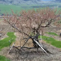
The result is a combination of privilege and poverty. There is control of land here, but look at it, or, rather, look at what it was 150 years ago.

So, that’s the land, or, rather, what a cattle-trampled bit of it looks like today. Still, it gives us an idea of what was here, a grassland reflecting the care of Indigenous people, just as the land reflects the care [sic] of the people who followed. So, let’s look again:
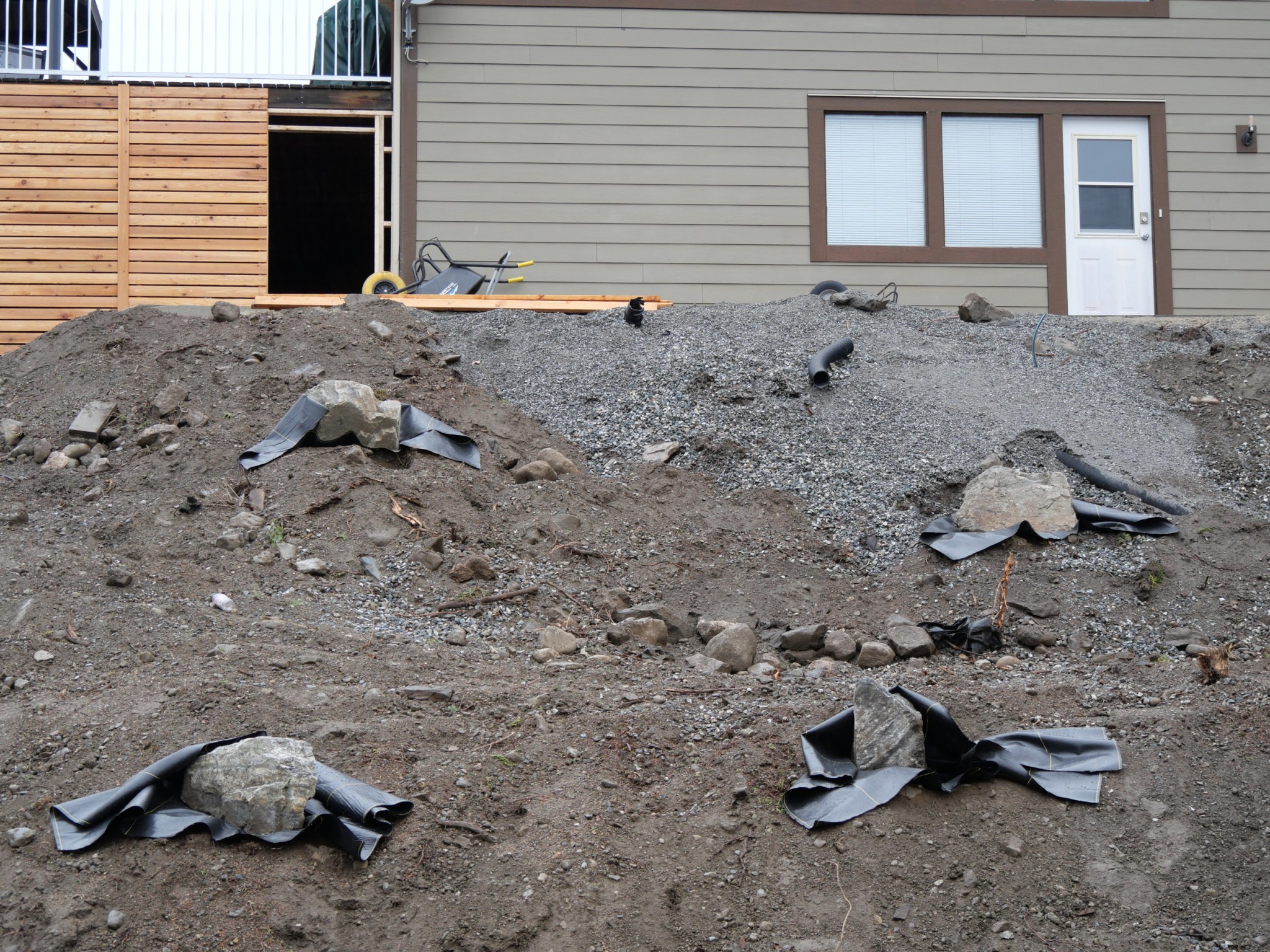
Another House in Vernon, just uphill from the one before.
The land, as you can see, has been stripped of all life, and that includes the Syilx people, their grassland, the ranch that followed, the Japanese orchard that followed that, and even the shrubs and bushes of the house that followed that, shelter for quail and deer. Now, it is being readied for a return to a primal, lifeless state, as it was 12,000 years ago, the day the glaciers were gone. Permeable cloth is being set under decorative stones (like glacial erratics), to allow water to soak through but no seeds to sprout upwards. This cloth will be laid over the entire surface, and then the whole thing will be covered in gravel, all at great expense, to actually kill the living land, on purpose. So, is it really land that is desired here, or a home for some and the elimination of others? Isn’t that called a form of security born of violence and protected by power? Here it is in a more dramatic form. Perhaps that will help to clarify the view:

Rattlesnake Ridge
During the Cold War, this ancient Wanapum spiritual site and hunting ground was the most secure site in the United States, protected by a top secret radar station, accessible only to troops guarding the plutonium reactors of the Hanford site (behind us as we look out into this view) from Russian incursion. The land in the foreground, an ancient bulb-gathering ground of the Sinkiuse, was plowed up, seeded with a variety of non-native grasses, and poisoned with radiation, in an experiment to determine its effects on living things. Despite all of that, despite that enforced poverty, it is now a nature reserve, and the last reserve of many species in the Columbia Basin, the great river of the West. And, looking a little farther north…
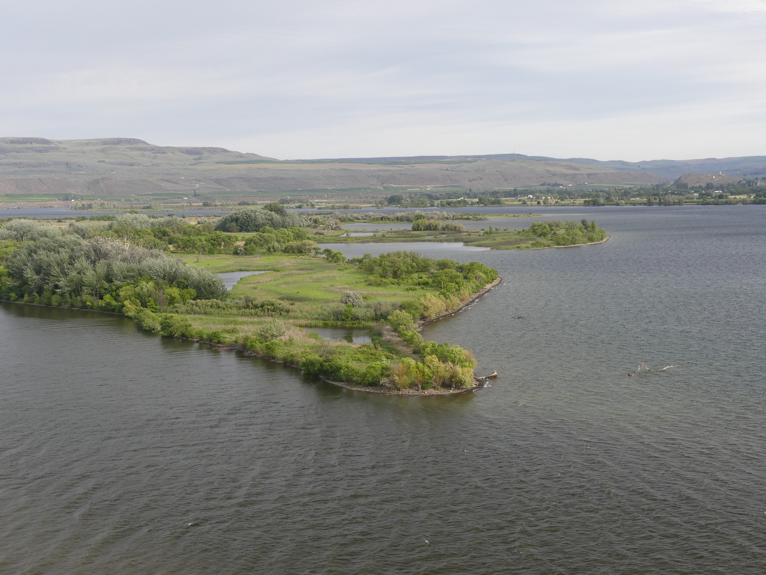
The Okanogan River (lower right) enters the impounded Columbia (left)
This green land once stretched out beyond the right edge of this image, and was a dry grassland plain rimmed with trees, the property of the Syilx (Okanogan) people. There’s more than one way to separate people from land, without valuing the land at all. Just as with Rattlesnake Ridge, the issue at hand is one of security. That seems a pretty basic need: to be secure. In this model, it is achieved at the expense of others and of the land. It wasn’t always that way. In the heart of the continent, in the Pays d’en la Haut, the high country of New France, the old Northwest …

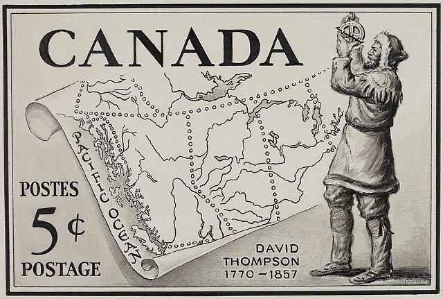
Le Pays d’en la Haut, 1755. Source.
aka The Upper Country, or just The Northwest. (The Pacific Northwest I am discussing is its westernmost extension, which the Northwest Company entered in 1793 (in the north) and 1809 (in the south).
…the indigenous use of slavery as a series of bonds and alliances evolved into a mechanism to force the French to maintain old alliances (with the Sioux) and prevent new ones (with the Paiutes), effectively blocking the expansion of New France and its economic stability. In other words, the Great Basin, the doorway to the West (the lilac-coloured block in the map below) was blocked to France by this simple move, which divided local French representatives (and their greed) from the French administration in Quebec and Paris. The empire, unable to control land, citizens, allies or violence, crumbled.

Some details:
- As early as 1680, the French allied with the Pawnees and raided both the Apache and the Spanish, who were enslaving the Apaches from the west.
- The Sioux made hundreds of raids on the Foxes. Tens of thousands of men and women were slaughtered, and thousands of their children, as young as four years old, were given as diplomatic gifts to military leaders and traders in Detroit and Michilimackinac. They were eventually transported to Montreal and sold for a quarter of a military governor’s year’s wages.
- These children served as domestic servants for the wealthy and the powerful, including the clergy. They were poorly fed and clothed and slept without bedding on the kitchen floors of the city’s grandest houses.
- Most died young.
- The practice bought the Sioux and the Iroquois access to French weaponry.
- More importantly, it denied it to their enemies.
What’s more, pressure from various forms of Indigenous slavery preceded the French deep into the West. In sum, there may never have been a continental United States without the Sioux manipulating the French by capturing alliance slaves and selling them into their desire for property slaves (and the status and privilege that came with them.) Individual French men and families (and churches and government officials) gained status, but France gained no land. Isn’t that the same condition we are still in, though?

Vernon, British Columbia.
Frind Vineyards purchased this old gold mine above Okanagan Lake to plant a prestige vineyard, but has had to actually create land to do it with. That includes scraping the top soil, such as it is, from the slopes in the centre and right of the image and spreading them out on the sloping field below (to the left). The resulting erosion has shut this portion of the project down for two seasons now. Mr. Frind will, in the end, get his prestige winery on the top of the hill, with grapes grown elsewhere in Priest Valley and Westbank. The land, though, remains as little the goal as it ever was, as little under his control, and as little a part of his prestige. That will be his money and the power it wields, just as it was in New France.
It’s amazing just how long these things live on. After the fall of New France in 1763, the practice continued among the English, almost to the end of the century. By the time either group of colonizers reached new territory, their slavers had been there long before. When David Thompson arrived in the Bitterroot Valley in 1809, for example…

David Thompson taking an astronomical observation [In a place that looks a lot like the Bitterroot]
Drawing by Charles William Jefferys
Acc. No. 1972-26-1406
Library and Archives Canada
…he was guided by Iroquois guides from the Kahnawake Mission in Montreal.

Kahnawake in 1670
Note the church. See below:

It’s like a fortress!
David Thompson’s boatmen had been raised Catholic and had likely grown up among slaves and slavers, or had lead trapping expeditions among them in Michilimackinack or Detroit. Dave?
David Thompson: Dahvit. The whole crew is French.
Were they your slaves?
Dahvit: You woke me from the dead to ask that? Man, they skinned me alive.
So, you were their slave?
Dahvit: A whole boatload of them abandoned me in the Bitterroot.
Well, it’s pretty nice there.
Dahvit: (Sighs.) Yeah.
Do you think they already knew the country?
Dahvit: Like, they planned to abandon me all along and just used my money to get there?
Yeah.
Dahvit: Who knows. They were French. City types, you know.
Ah. But you weren’t their slave?
Dahvit: Nooooooooooo….What makes you think that?
Oh, nothing.
~Harold Rhenisch interviews David Thompson, November 2022~
These boatmen will go on to have a far greater role in Plateau history than David Thompson, but he gets the prestige stamp.
Apparently, we shall not talk of the lost territory to the south, which his boatmen eventually gave to the United States. No way. Certainement pas. Kwates (Chinook Wawa) (Don’t worry. We will meet the boatmen again.)
So, to summarize: violent diplomacy run by Indigenous society is what Pandosy rode into in 1847. When Peopeomoxmox sent him across the river, it was as a slave. Well, either that or as a bargaining stick with the spirit world, which is, really, pretty much the same thing. You can read a little bit about all that here: https://okanaganokanogan.com/2015/10/21/illahie/. Until next time, here’s David’s boatman in his old age:

Ignace La Mousse
The real founder of the West?
Stay tuned.
Categories: Agriculture, First Peoples, Grasslands, History, Pacific Northwest


Harold,
Is the coloured map source available? I would like a copy so I can enlarge it.
Also, I am aware of the fluid boundaries of territories; I was wondering about the date of the map.
Thank you for any help you can offer me.
Shalom,
Curt
LikeLike
This one?
sorry, I forgot the link
So, I’m curious, what are you using the map for?
blessings
Harold
LikeLike
I’d like the map to lessen my ignorance. cg
LikeLike
Thanks for the map.
cg
LikeLike
Finally!! Other than Hollywood version of Indigenous occupation, colonial propaganda, urban imagination and post modern spritualism.
Not sure of the value or reason of comparrisons with current land developers? Is there a point other than things don’t change?
LikeLike
Basically, yes, things don’t change. You’re way ahead of me, though. I’m going to build my case around Father Pandosy’s experience, which I will then use to try to untangle the knot of Whiteness that is the current Okanagan (and a lot of Washington as well). I figure it’s worth a try. But your question has landed well and I will see what I can do to but some depth behind that foray. Thanks.
LikeLike