


Names are slippery. A popular one these days is “The Pacific Northwest.”
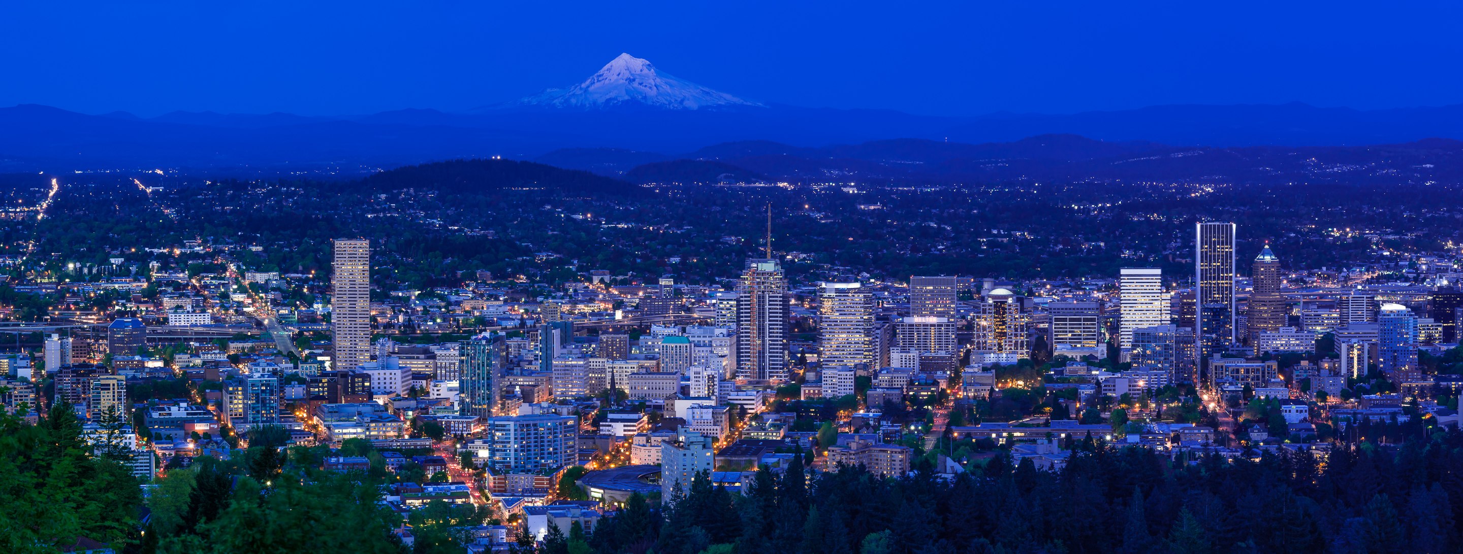
Portland: A Settlement in the Pacific Northwest, with the ancestor Wy’east in the Background
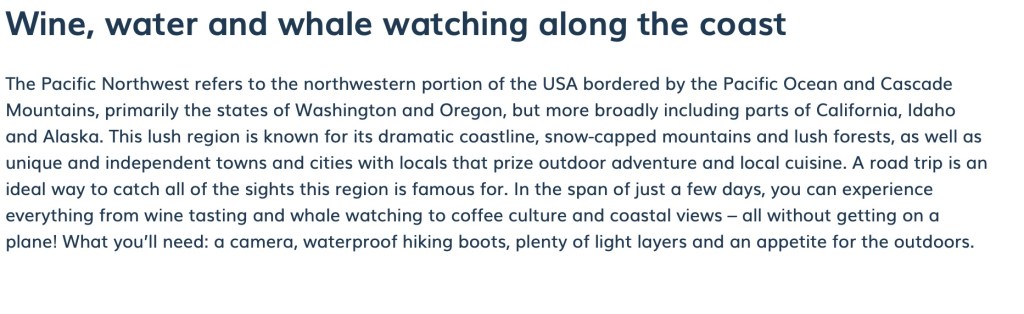
Don’t believe everything you read about it, though.

For instance, do not believe this site.
It’s just plain wrong. Like this:
For one thing, it erases any part of the region that is not on the Coast. Does this region in the heart of the region look like a lush coastal forest?:
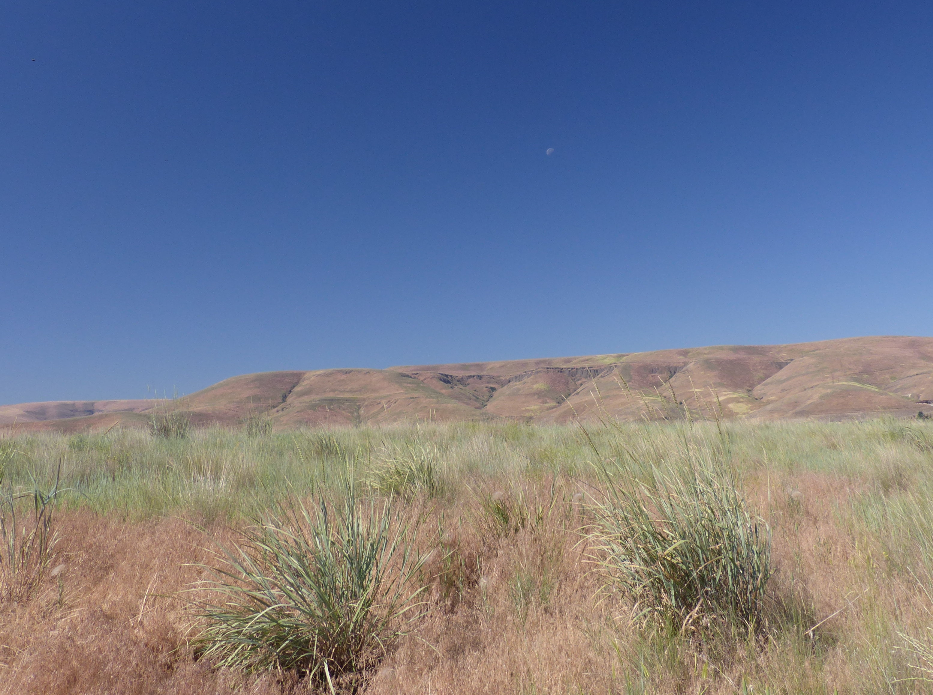
The view of Clarkston, Washington from Lewiston, Idaho
For another, it assumes that Pacific “Northwest” means something tucked into the upper left hand corner of the contiguous USA:
Wikipedia takes a stab at more accuracy, but still manages to flop:

Source: https://en.wikipedia.org/wiki/Pacific_Northwest
At least British Columbia is in there, but the whole thing is so unanchored that I think an AI Bot wrote that by cruising the internet and then showing off to its own kind, while forgetting that some biological entities were still in the room, much in the way early American and European explorers wrote smugly about the region as if its Indigenous people weren’t there. Here’s how Washington Irving…

Washington Irving Holding Forth Without His Beaverskin Hat
The hat is to the left.
… handled it all in his book Astoria:

…talking about, presumably, the Tsinuk:
The effect of different modes of life upon the human frame and human character is strikingly instanced in the contrast between the hunting Indians of the prairies, and the piscatory Indians of the sea-coast. The former, continually on horseback scouring the plains, gaining their food by hardy exercise, and subsisting chiefly on flesh, are generally tall, sinewy, meagre, but well formed, and of bold and fierce deportment: the latter, lounging about the river banks, or squatting and curved up in their canoes, are generally low in stature, ill-shaped, with crooked legs, thick ankles, and broad flat feet. They are inferior also in muscular power and activity, and in game qualities and appearance, to their hard-riding brethren of the prairies.
Source: https://www.gutenberg.org/files/1371/1371-h/1371-h.htm#link2HCH0004
This distasteful harangue makes one homesick for the Bot. Well, almost. Unfortunately, the Bot’s game of historical blindness and erasure goes on:

A bit of a slap-dash dismissal of the Northwest Territory. Let’s look more closely:
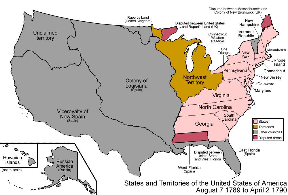
No British Territory to the North!
Good grief.
Here’s a somewhat better map:
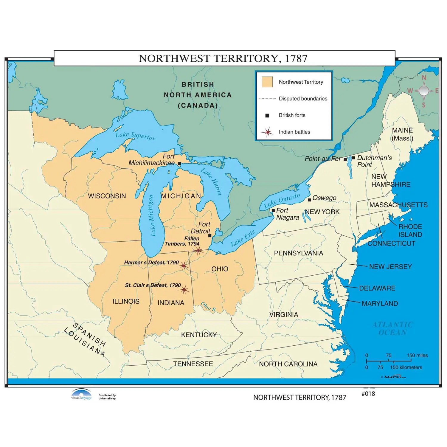
And, with the real owners:

Keeping your eye on Spanish Louisiana (formerly New France, ie Canada, as was the Northwest Territory), look below at what happens after France cedes Louisiana to Spain (1762) and Spain sells Louisiana back to France (1800), which then sells it like a hot potato to the United States (1803):
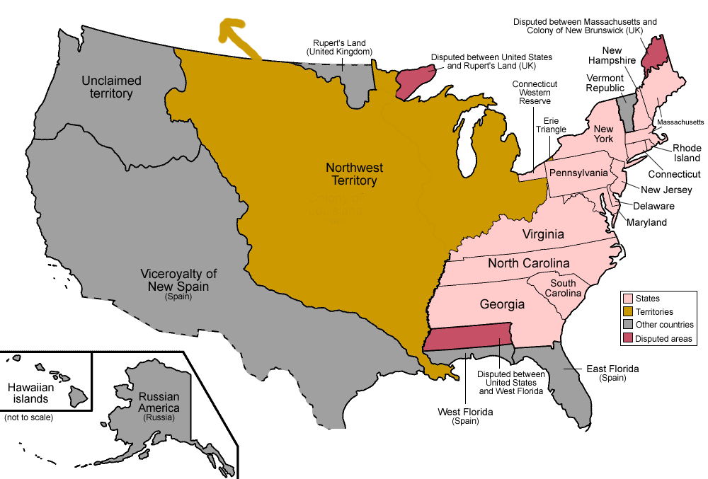
Yes, the Northwest extends north into Blackfoot and Cree Territory to
And then, if one pushes into formerly inaccessible territory blocked by Spain to the west…

And there is the Pacific Northwest! Yay!
Yes, it extends north, all the way to Russian Alaska. Basically, the Northwest is all the land upriver from New Orleans, with the Western piece tacked on after the Sioux, Spanish and Blackfoot blockade of it was broken.
Still, let’s be cautious with these maps. This is neither British, Spanish, French nor American Territory. It’s more like this.

This is Indigenous Territory, Belonging to Many Nations
Yes, there are people in the grey bits up North, too.
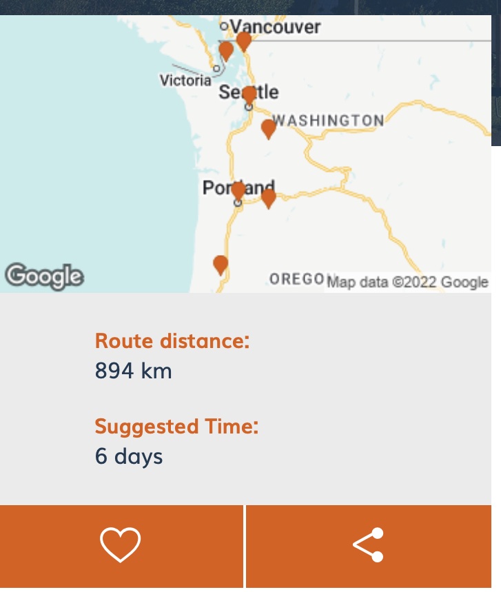
Still, even the American version of the Pacific Northwest is better than what it has become on Wikipedia:

Well, that determining border is important, but so is 16,000 years of Indigenous history, as well a the Earth’s history and character here:

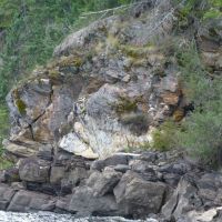
Asotin Creek Enters the Pik’dunin
This was the great Heésu (Lamprey Eel) fishery of the Nimiípu’u. Extirpated eels were re-released here in April 2022. Asotin was also one of the major urban areas of a people who trace their history here back into the glacial age.
This “Northwest” and this “Pacific Northwest” are touchy subjects, all in all. It’s not really enough to claim, as the Wikipedia article does, that an ignorance of history means you can call things whatever you want. The history is still there, and still determining the present and the future. It includes the War of 1812 and the French and Indian Wars that preceded it. It includes the Cherokee exile and various failures to set aside land for mixed race people in the Northwest. It has to do with the Hudson’s Bay Company, with race and with religion. It’s all rather complicated. The borders its story creates are going to lead to war and to the divisions within Cascadia, and even to its creation.

This is as Bad as the Middle East
Alaska, Yukon, Haida Gwaii, British Columbia, Vancouver Island, Washington, Oregon, California, Idaho, Montana, Nevada, Colorado and Wyoming, aka Cascadia. Lines drawn on a map. There is a reason for them. The reasons are more important than the lines.
To compare, here’s the Middle East:

Not Real Borders, Either
Before this kind of division the region continued right on down into California, Nevada and Utah. The Canada/US border is a treaty line in a longer battle. It does not conveniently separate what came before it and what followed. Over the next few posts, I will present a few historical stories to show the depth of this change. It is these borders, more than the national borders of today, that determine this land’s future. Until then, though, let’s imagine what this country might have been as a political space, before it got divided by rulers laid across maps. That should, I hope, help us see what is really here.
Pre-Contact Trade Centres in Western North America
Note that Celilo Falls (The Dalles on this map, in red) is the dominant trade centre for the entire Pacific Coast, and the largest trade centre for a quarter of the continent. You can follow the trade lines expanding from there. The rest are in Mexico and Louisiana, in other words in New France and New Spain. They weren’t set up by the colonial powers. The powers came to them, to trade.

Horsethief Butte
Centre of a city of 40,000 traders every summer. Note the lack of lush vegetation and the pothouse ruins in the foreground.
Next, we will follow Simon Fraser as his crew enters this trading district from the north. From there, we will enter into Métis history, and from there to the Cayuse War of 1848.
Categories: History, Nature Photography


Worthy investigation. Contemporary Cascadian “consciousness” and “identity” entertain no shortage of false, facile historical narratives and self-serving “border” constructs, not seldom as a matter of personal choice, political gain, or “in my opinion” interjection, the sort that one associates with social media or comment panels such as this one :-). Unfortunately, such hasty, ill-informed constructs then become the target of unfair critiques and blowback. A vicious cycle of misinformation.
Re: The map of Al-Jazeera, “the island”, modern day Saudi Arabia. Note, that the US military continues – as it has since its formation – to employ the label “Indian Country” when referring to any foreign land or enemy territory it invades and occupies.
LikeLiked by 1 person
Good point! I will see where that leads. Thanks.
LikeLiked by 1 person
Fascinating: thank you. Trade centres that radiate out like sparklers!
LikeLiked by 1 person